David Sankson
Know before you go
Dogs
Guide dogs and Assistance dogs only due to sensitive wildlife
When to visit
Opening times
Open at all timesBest time to visit
All yearAbout the reserve
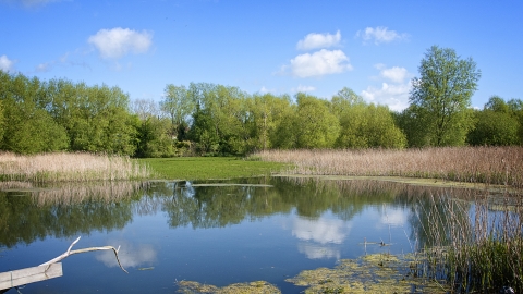
Magor Marsh is one of the last remaining pieces of natural fenland that once covered the Gwent Levels. Wetlands like this used to be commonplace across Britain but they are now one of our most threatened habitats. It was the threat of losing this important place in the 1960s that brought local naturalists together to fight for its survival, banding together to form what is now known as the Gwent Wildlife Trust. With the more recent addition of Barecroft Common to this reserve, we are able to protect even more of this special place and its wildlife.
The landscape is a mosaic of habitats that nurture a rich diversity of wildlife throughout the year. The marsh comes alive with bird song in spring as Cetti’s warblers flit between the reeds and scrub and cuckoos give their distinctive calls. In summer, there is an explosion of colour as wildflowers carpet the meadows and the air is full of insects as they feed on the nectar-rich flowers. As the pace of life begins to slow in autumn, it is the best time to see the flash of colour as kingfishers dart along the waterways. In winter, the pond becomes the centre of attention and you can watch the flocks of teals and shovelers from our birdwatching hide. You may even get lucky and see an otter!
What we do here
Managing water levels is an essential part of our work to keep the different habitats, and their wildlife, thriving. The reserve is fed by underground springs and, using a system of sluices in the reens and ditches, we are able to move water around the reserve to create the perfect conditions.
We have built a kingfisher and sand martin bank on the reserve to provide nesting sites for these species and in 2011 we embarked on an exciting project to return water voles, one of Britain’s fastest-declining mammals, to Magor Marsh. All the signs suggest they are doing well and are now spreading out across the Gwent Levels.
History
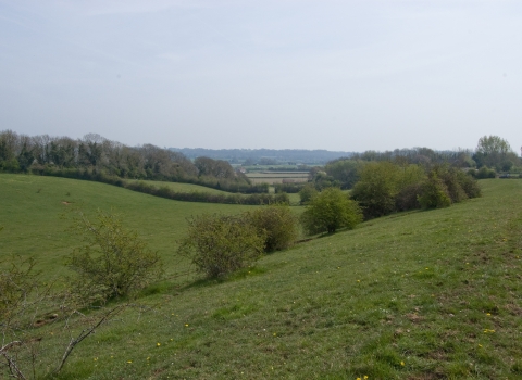
The Gwent Levels is an ancient landscape, carefully and purposefully managed by man for thousands of years. Prehistoric footprints preserved in the mud of the nearby estuary shows this was a hunting ground for early man. The man-made drainage ditches that criss-cross the reserve could date back to Roman times and a near-intact Roman boat was found just a mile from the reserve.
With several nationally significant archaeological finds, the Gwent Levels has been designated a ‘Landscape of Outstanding Historic Interest’.
Directions
By car
Exit the M4 at Junction 23A and take the first left, signposted ‘Magor/Caldicot’ on the B4245. At the roundabout, take the 3rd exit to Magor. After entering Magor, take the right turn signposted ‘Magor Square’ and with a brown tourist sign for Magor Marsh below. Follow the road round to the right (signed Llandevenny/Redwick’) and past the ruins of the Priory. After crossing a narrow railway bridge, turn left immediately and follow this road for about 400m and reserve entrance is on the right.
By bus
From Newport, Magor town can be reached on bus route 74. Disembark at ‘Magor-Withy Walk’ bus stop and it’s a short 10-15 minute walk to the nature reserve via Redwick Road. Cross over the railway bridge and turn immediately left onto Whitewall.
Near the reserve
There are four other Gwent Wildlife Trust nature reserves you can visit in this area – Great Traston Meadows towards Newport and Brockwells Meadows, Lower Minnetts Field and Rogiet Poorland just north of Magor.
The village of Magor has good local pubs and an attractive square. Redwick is also nearby, with refreshments available at The Rose Inn. Visit the Church of St Thomas the Apostle where the height of the water during the Great Flood of 1607 is marked on the wall.
Contact us
Environmental designation
Join us!
Help protect and support our beautiful nature reserves and local wildlife. Join our community of members today!

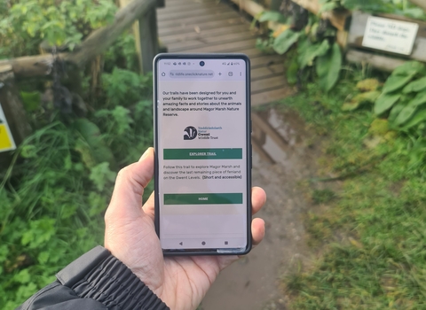
Magor Marsh Digital Guide
If you visit the reserve there is a whole new web browser based app, including a digital trail available at Magor Marsh, think of it as an interactive leaflet that can guide, inspire, challenge and entertain you during your visit.
Make sure to check it out when you visit - there is a poster with a QR code in the notice board by entrance.

